

**This research was first published in the January 28, 2026 edition of the Chatham Star-Tribune newspaper as part of Kyle Griffith’s weekly segment entitled “Heritage Highlights.”
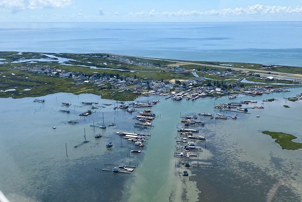
Aerial view of Dock entry at Tangier Island; photo by Kyle Griffith in 2022
The small island communities of the Chesapeake Bay have eroded significantly over the last few centuries, and many have been lost entirely. When early colonial settlers arrived in Virginia by ship in the 1600s, they mainly entered through the Chesapeake Bay. While most continued inland, others settled among the dozens of small islands scattered throughout the bay. These isolated communities developed one of the most unique forms of Virginia culture. Tangier Island is among the most endangered by erosion and is at risk of abandonment before the end of the century.
On late seventeenth century maps such as Augustin Hermann’s 1670 rendering of Virginia, a long chain of clustered islands appears under the name “Racer’s Straits.” By 1715, the southernmost cluster was labeled “Tanger Ile,” or Tangier Island. John Smith’s map from about a century earlier had first labeled them as Russel’s Isles. On modern maps, about five miles to the north, a similar place called Smith Island is situated along the Maryland-Virginia border. The Fox Islands, once prominently marked as the Great Fox Islands and the Little Fox Islands, have nearly vanished into the Pocomoke Bay. In a map from 1840 titled “A Chart of the Chesapeake and Delaware Bays” by Fielding Lucas Jr., all islands in the Chesapeake are more precisely labeled and drawn. The Tangier Islands appear as a group of about three primary island masses, and a few minor masses, riddled with shoals at the north. The sand spit at the southern end of Tangier was illustrated like a scorpion-tail shaped curve, which over time has been reshaped by the waves and appears nearly straight today.
Tangier is among the few Chesapeake islands accessible by small aircraft, with a public airport built in 1969 that occupies much of the western edge of the island. A couple of cars can be spotted in Tangier, but most people travel by foot, bicycle, moped or golf cart with a 15 MPH limit. Ask for directions and a local may reveal a distinct accent descended from their ancestors from Cornwall, England centuries ago. Their “Ocracoke Brogue” can be considered one of the most authentic examples of how the dialects of early Virginia settlers sounded during the 1700s.
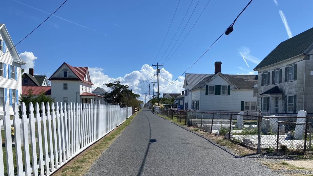
Common street view at Tangier showing homes and graves; photo by Kyle Griffith in 2022
For being a small island, there are quite a few regions on their hand-painted local map in the Tangier History Museum. Tangier is made up of three main ridges: West Ridge, Main Ridge, and Canton Ridge, with uninhabitable “Uppards” islands that were abandoned nearly one hundred years ago due to erosion. Each ridge is separated by channels with several long bridges between. The strip of homes hugging the perimeter of the runway is known as “Hog Ridge.” After passing the bridge over “The Ditch” or the Big Gut Canal is the community center in Main Ridge near the harbor. A few seafood restaurants, stores, and the Swain Church make up what is known locally as “Meat Soup.” Further toward the southern end of Main Ridge Road, or “King Street” is the community of “Black Dye.” Further east, one bridge passes over The Canton Ditch to a short road around a quarter mile long with roughly twenty houses. A 250-acre mass of Tangier called Port Isobel Island is situated to the northeast across Mailboat Harbor and now serves as an education center under the Chesapeake Bay Foundation. The main boat path through the channel is lined with dozens of small structures built by the watermen upon freestanding docks to store their boats, crabbing equipment, oystering, and fish trapping supplies.
At its height, Tangier had a population of about a thousand people in 1900, but that number has shrunk to a bit more than four hundred today. The island is physically one-third of the size it was during the mid-1800s, and only about eighty-three acres are now considered inhabitable. Today, about two hundred homes remain, but Tangier Island may face abandonment within the next fifty years. It is expected to become full marshland and eventually be submerged in the bay. Their history is a hidden culture of Virginia worth supporting and visiting before it is too late.