


Description
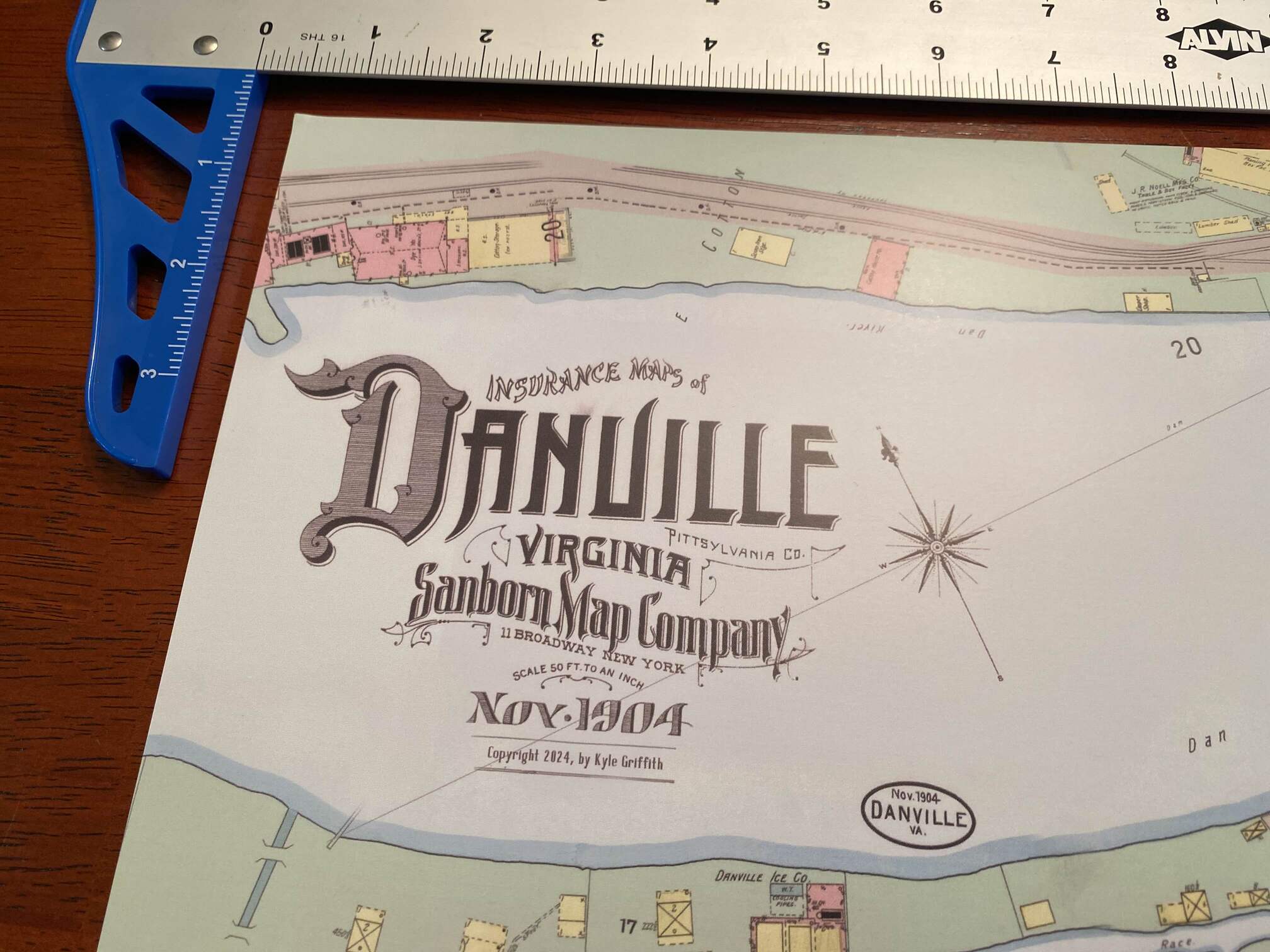
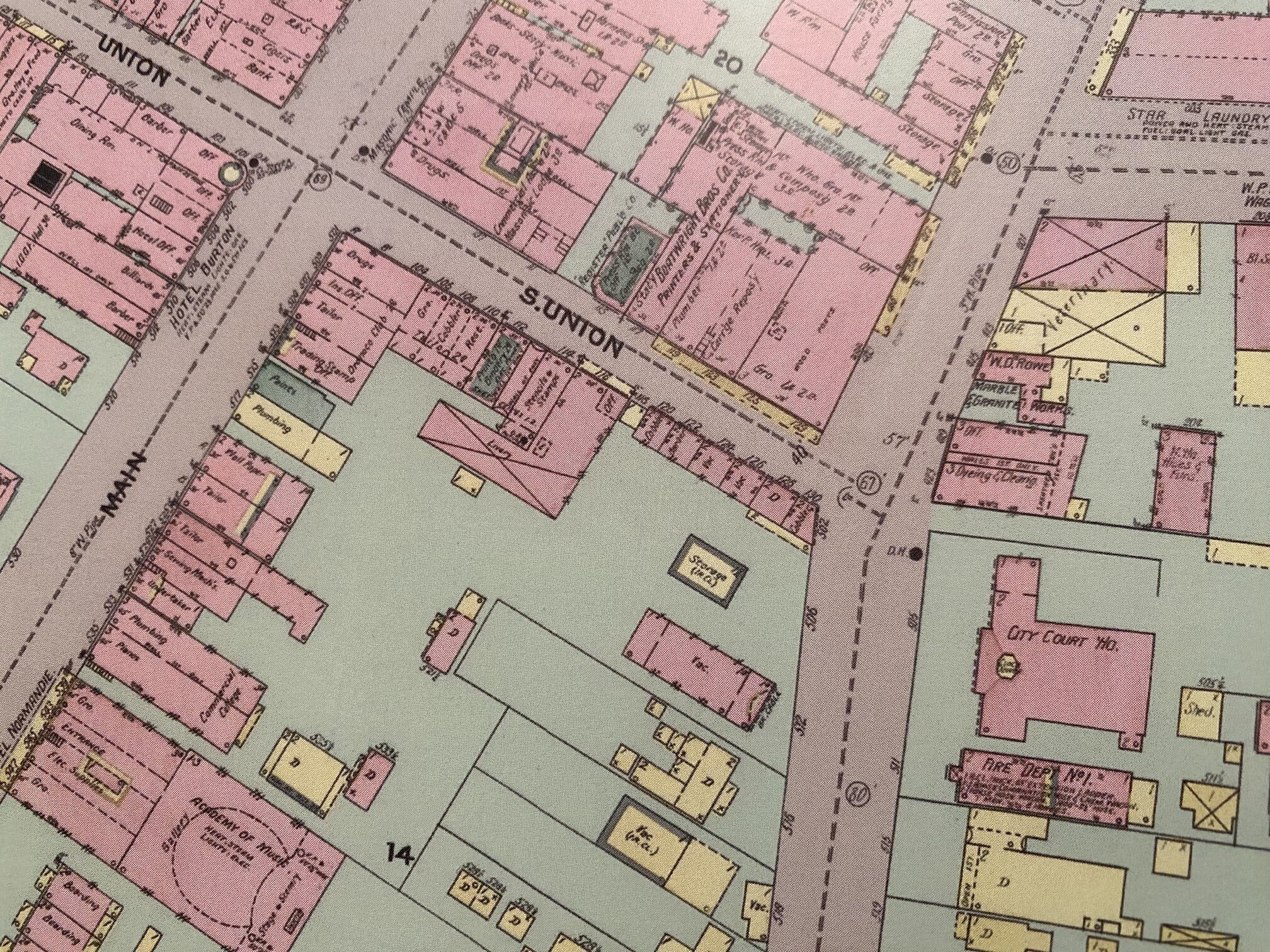
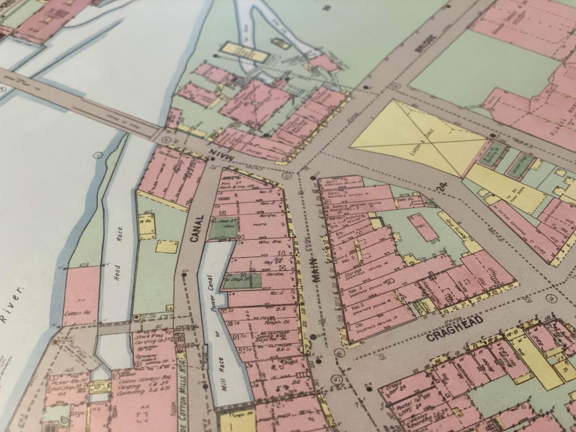
This map is made up of about eight individual maps published by the Sanborn Map Company in 1904. They have been merged together into one large map. The original maps colorized the buildings as such: red for brick, yellow for frame, and green for “special” material. This new map is updated with a green ground coloring and a gray color for the roads to pull the environments together and add more visual interest. It is recommended to view the map under a magnifying glass.
Reviews
There are no reviews yet.