

**This research was first published in the June 25, 2025 edition of the Chatham Star-Tribune newspaper as part of Kyle Griffith’s weekly segment entitled “Heritage Highlights.”
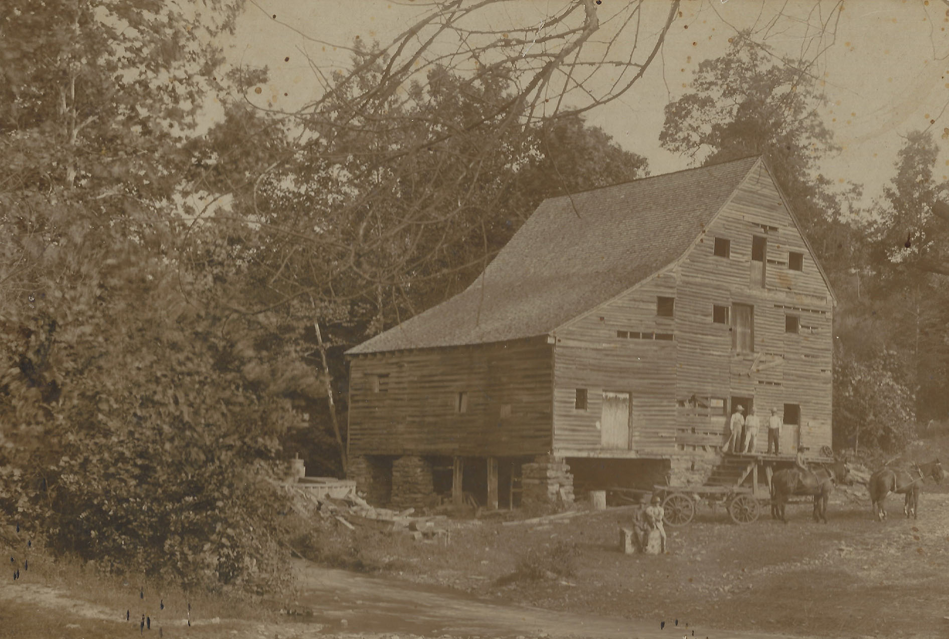
Pigg’s Mill as it looked around 1908 before renovations by the Jones family
During the mid-1800s, Pigg’s Mill entered its golden age of production and development, evolving from a simple log grist mill into an improved community center known throughout Pittsylvania County. Following the death of the family patriarch, Clement Pigg in 1849, his estate was divided among his widow and their sons and daughters, who were the fourth generation to inhabit that land along Pudding Creek of the Banister River.
To carry out the subdivision, a surveyor named William Robertson was hired to map the land. His plat is still preserved in the county’s chancery court records. It shows the division of approximately 2,065 acres into twelve parcels including noncontiguous land in nearby locations. The map also reveals the substantial millpond that fed the waterwheel. It includes references to old roadways including various unnamed mill roads, the Irish Road, and the “Danville Road,” which was likely part of today’s Jones Mill Road near Dry Fork.
Another accompanying sheet revealed who received each parcel. On the north side of the Banister River, Hezekiah Pigg, John Pigg, and Elisha Hardy shared a 112.5-acre tract next to Louisa Pigg Powell’s 96-acre tract that stretched to Bearskin Creek. On the south side of Banister River, Nancy Pigg Emerson’s 76 acres of woodland adjoined Paul Pigg’s land with 157 acres. The Irish Road passed through their parcels and continued into William Pigg’s 117-acre property. At the center of the plat map, including the mill site and most of the modern-day Jones Mill Road, the 334-acre widow’s dower for Nancy Elliott Pigg formed a core piece of the landholdings. To the south, following Pudding Creek, Banister Hardy was granted a 164-acre tract beside his brother-in-law Clement Pigg Jr. who had 129 acres.
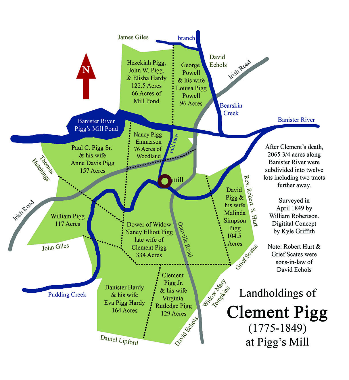
Graphic showing Pigg landholdings in 1850. See original drawing at the end of the article.
It’s notable that Banister Hardy first married Alsey Yates, a daughter of tavern keeper Stephen Yates, and they raised ten children together. After her death in 1834, Banister remarried to Miss Eva Pigg, and together they had at least nine more children which made him the forefather of most Hardy family lines in the Dry Fork area. In a further twist, Eva’s younger sister married one of Banister’s sons from his first marriage, making Eva both her sister and her mother-in-law at the same time.
Other documents within the chancery case included a receipt of various work completed for Clement Pigg by his son-in-law George Powell in previous years. Beginning in 1844 George made repairs to Clement’s house, cellar, and mill dam. The following year he was paid one dollar a day for ten days of digging ditches on Pudding Creek. He completed a wide variety of tough jobs including working on fences, “cleaning up swamp,” and hewing timbers.
Further receipts indicate that in 1840 Clement’s son David Pigg cut down trees from which he hewed the logs and constructed a house, rebuilt the kitchen, built a new corn crib, and built new stables. He also split rails, put up a fence “round the plantation” and around the crops. Four years later he put up fencing along Banister River and Bearskin Creek, and was also paid $10 to relocate a barn with further improvements made upon the siding. The last records in 1845 show he completed ditching on Pudding Creek, “also hauling logs to build one mill dam and repair another.”
Boundary descriptions from the 1849 survey also named several neighbors, including David Echols, James and John Giles, Daniel Lipford, Grief Scates, Baptist clergyman Robert S. Hurt, and a widow Mary Tompkins. By the 1850 census, both Hezekiah and Paul Pigg were recorded as millers. While the rest of the family were listed as farmers, the extensive improvements and documented labor show they were engaged in a wide range of work.
In looking at these old survey records and identifying their modern day locations, so many relationships and nuggets of useful information can be recovered. In those days the rivers and creeks determined the source of new communities and with each bend and meander there are interesting lives and legacies to be found. More about the Pigg family’s influence in the county’s history can be found in Kyle’s book from 2020 called “When Piggs Flew.”
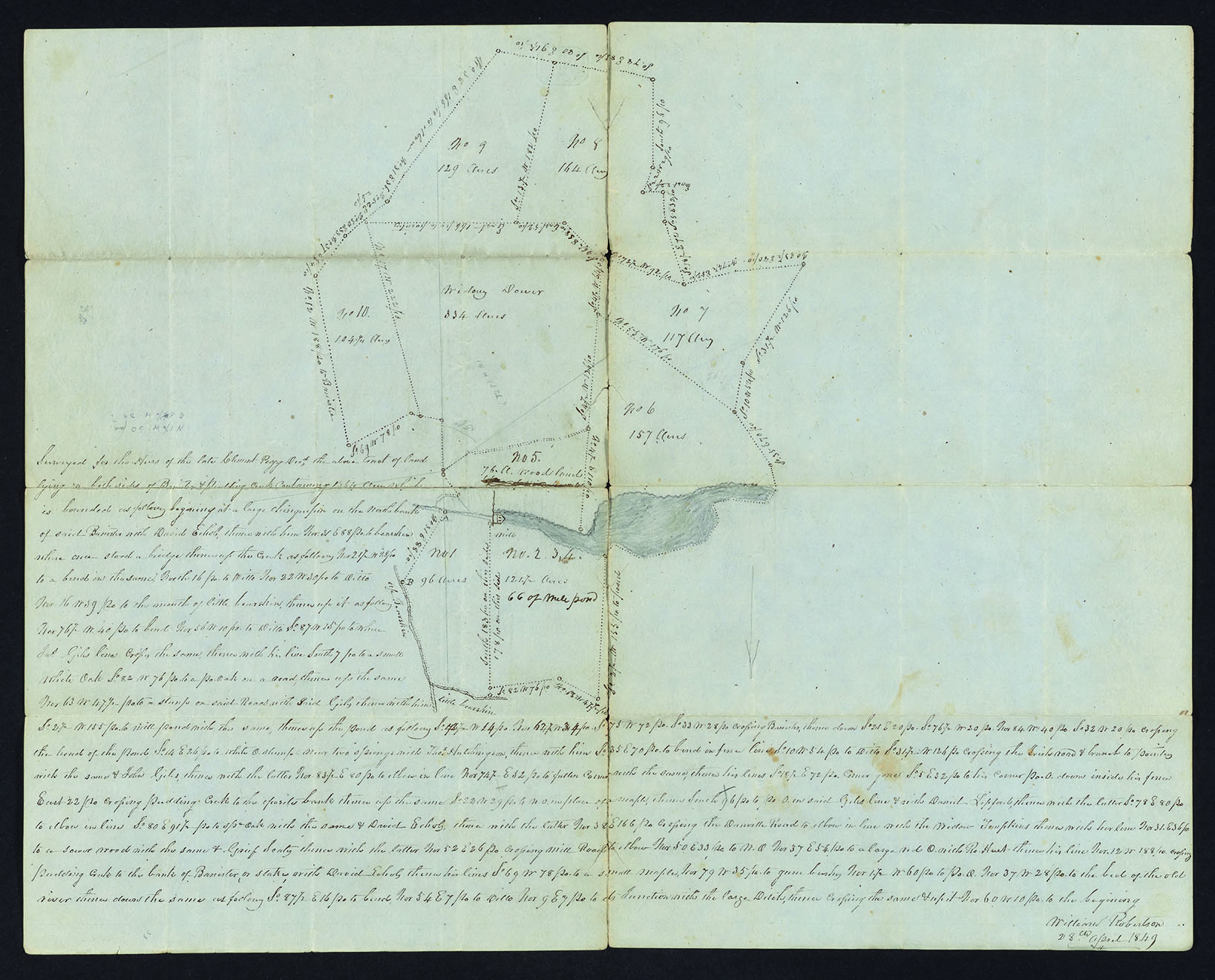
Original hand drawn plat map